


What caused the Palm Beach Learjet crash? Inside the jet’s final minutes
An illustrated analysis of the Learjet’s final flight: the climb request, icing over Florida, rapidly increasing descent speeds, and the forces that complicated recovery.

PALM BEACH COUNTY — The final minutes of Learjet 60 N722BD began with an attempt to climb above difficult weather. They ended in a steep, right-hand descent that grew faster as the aircraft lost altitude. Between those two events, the crew’s radio calls changed from a request for a different flight level to an emergency involving both excessive speed and an extraordinary rate of descent.
The available flight tracking and communications point to a loss of control at high altitude, followed by an accelerating dive. Understanding the crash requires separating two questions: what first upset the aircraft, and why the resulting descent became so difficult to arrest. The flight path helps explain the second question. The initiating cause remains under NTSB investigation.
The FAA placed the crash near Cresthaven at approximately 12:50 p.m. on November 1. The jet was flying from Austin, Texas, to North Eleuthera in the Bahamas with nine people aboard. Transportation Secretary Sean Duffy said all nine died, according to the Associated Press.
- 41,000 feet: Earlier cruising altitude.
- 35,000 feet: Flight level before the final climb attempt.
- Above 32,000 feet per minute: Peak descent rate reported by Flightradar24—roughly 364 mph downward or faster.
- 8,750 feet: Last altitude received by Flightradar24.
From cruise flight to a climb request
Flightradar24’s account of the flight places departure from Austin at 15:37 UTC, or 10:37 a.m. Eastern. The Learjet reached 41,000 feet before beginning a descent near Naples at approximately 12:35 p.m. Eastern, heading toward 35,000 feet.
That earlier descent was a change between cruising levels. At 35,000 feet, the jet was still about 6.6 miles above sea level. The later emergency developed far above the scene visible in the ground videos.
The radio exchanges described by AP included turbulence, ice accumulation and a request to climb another 2,000 feet. The requested destination was therefore 37,000 feet. The purpose was to change the conditions the crew was encountering; the aircraft’s next intended movement was upward.
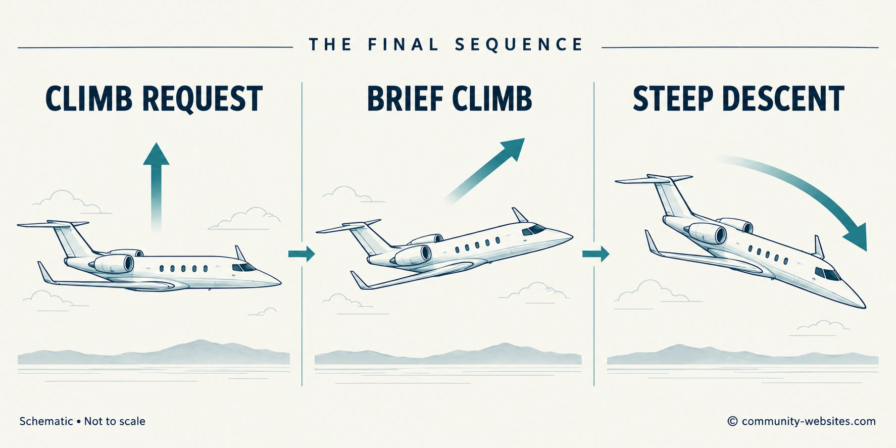
Flight tracking shows a brief climb at about 12:48 p.m., followed by a steep descent to the right. That reversal is the critical transition. The airplane moved from a climb attempt into a flight path with a rapidly growing downward component and a changing direction.
A flight tracker plots where an aircraft travels. It does not show the pilot’s hands, the selected autopilot mode, the force on the controls or the airflow over the wings. Those details matter when explaining the first seconds of an upset. The public track establishes the broad sequence while the radio calls describe the emergency the crew was experiencing.
Why ice can form on an airplane over Florida
Warm weather on the ground does not mean warm air at cruising altitude. Florida’s palm trees and warm surface conditions occupy the lowest part of a much deeper atmosphere. Air generally becomes colder with height through the lower atmosphere. Several miles above the state, an aircraft can encounter temperatures many degrees below freezing while people below experience a warm day.
The freezing level—the height where the air reaches 32°F—changes with the weather. Above it, clouds can contain a mixture of liquid droplets and ice particles. An airplane flying over Florida can therefore pass through the same basic ingredients for icing as an airplane over a colder state: moisture and sufficiently cold conditions.
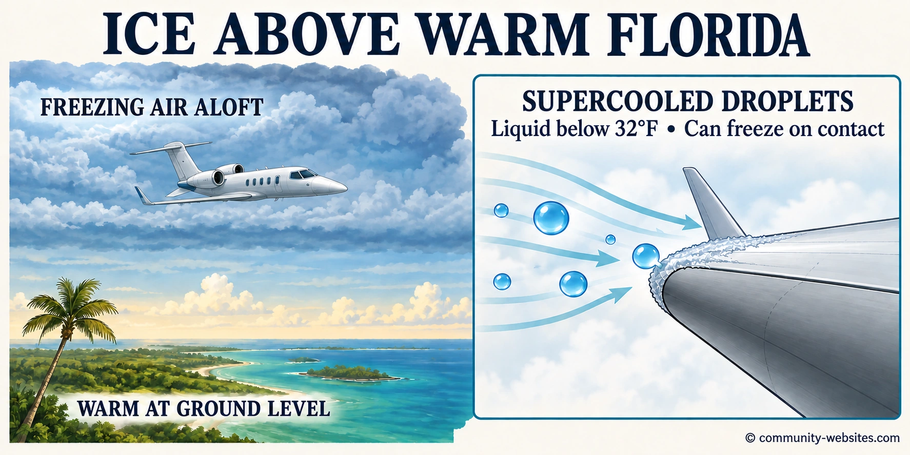
The less familiar ingredient is supercooled water. Tiny cloud droplets can remain liquid even after their temperature falls below 32°F. When they strike a cold aircraft surface, they can freeze and adhere to it. Repeated impacts can build an ice deposit along exposed surfaces, including the front edges of the wings. NASA’s icing guidance explains why both temperature and liquid water matter: cold air alone does not coat an airplane with ice.
Strong upward air currents in growing clouds can carry moisture into colder layers. Florida’s warm, humid air at low levels can help supply that moisture. The atmosphere is not a single uniform temperature, and the conditions inside a cloud can change considerably with altitude. The FAA’s Aviation Weather Handbook describes how vigorous cloud development can carry supercooled droplets to great heights.
Ice is a concern because a wing relies on its shape and the movement of air around it. A rough deposit can disturb that flow, increase drag and reduce the wing’s ability to generate lift. The effect is more complicated than simply adding weight. Changes to the wing’s surface can also alter its stall characteristics—the conditions under which it stops producing lift effectively.
There is a further distinction at very cold, high altitudes. More of the cloud’s water is already frozen into crystals. Those crystals generally behave differently from liquid droplets striking a wing. The National Weather Service describes a separate ice-crystal hazard in which particles can partially melt and accumulate on warmer surfaces inside an engine.
That distinction is relevant to the investigation. A crew’s icing observation, the temperature at a particular moment and the condition of the aircraft’s ice-protection systems must be considered together. Florida’s surface climate does not rule out an icing encounter, but identifying the type, location and effect of that ice requires the flight’s actual weather and aircraft data.
The radio calls: height was disappearing rapidly
During the descent, the crew reported a rate reaching 10,000 feet per minute and then an overspeed condition at 20,000 feet per minute. AP quoted the transmission: “We are in an overspeed condition descending 20,000 feet per minute.”
The transmission described two simultaneous problems. The aircraft was losing height rapidly, and its speed had exceeded an operating limit. One describes the steepness and rate of the descent; the other concerns the airflow and forces the airplane was experiencing.
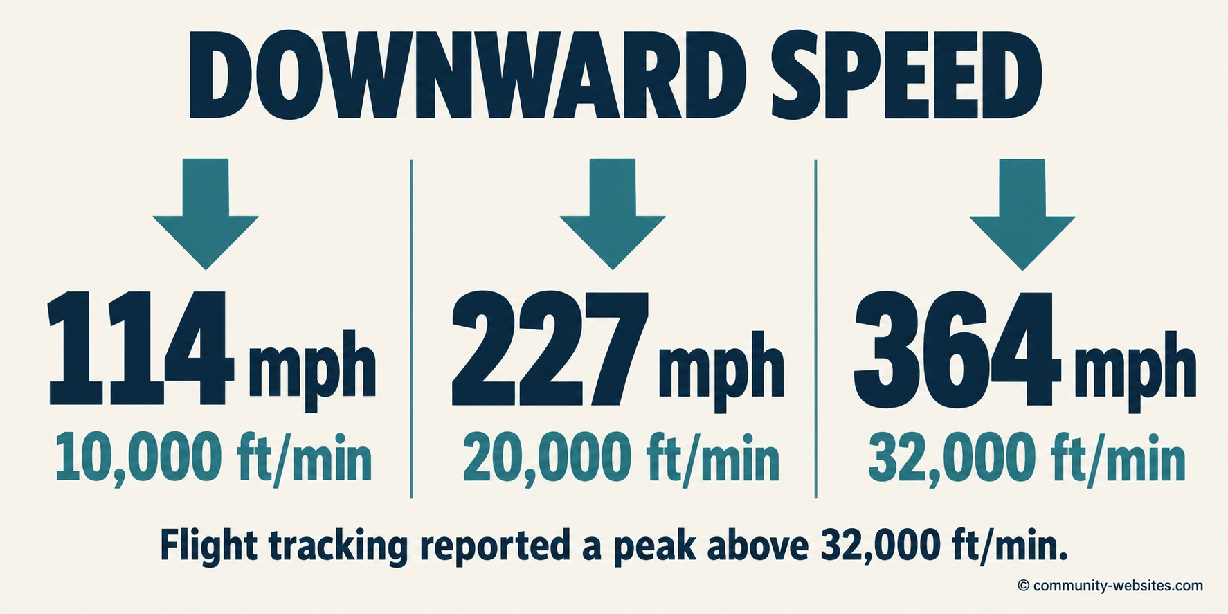
At 10,000 feet per minute, an aircraft loses about 167 feet of height each second: 114 mph downward. At 20,000 feet per minute, the figures become about 333 feet each second and 227 mph downward. A descent rate of 32,000 feet per minute corresponds to about 533 feet each second and 364 mph downward.
Flightradar24 reported a peak exceeding 32,000 feet per minute. The mph figures translate those vertical rates into familiar units; they do not describe the jet’s total speed through the air.
The arithmetic shows how quickly recovery room can disappear. Sustaining a descent of 20,000 feet per minute would consume 5,000 feet in 15 seconds. At 32,000 feet per minute, the same loss would take about nine seconds. These constant-rate comparisons illustrate the shrinking time available as a dive steepens.
Airspeed, groundspeed and downward speed
A descending airplane can move forward and downward at the same time. A person watching a video sees the combined motion. A tracking service may display several separate measurements, each answering a different question.
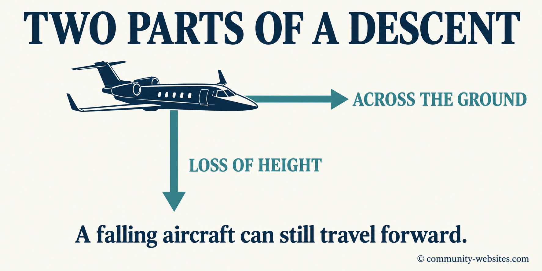
Groundspeed describes movement across the Earth’s surface. Vertical speed describes the rate of climb or descent. Airspeed describes motion relative to the surrounding air. Wind changes the relationship between airspeed and groundspeed, which is why one cannot automatically be substituted for the other.
Mach number compares an aircraft’s true airspeed with the local speed of sound. That speed of sound varies with temperature. A jet’s high-altitude operating limit may therefore be expressed as a Mach number rather than a single mph figure that applies everywhere.
ADS-B Exchange’s data definitions treat groundspeed, vertical rate and available airspeed information as separate fields. A headline number taken from one of those fields needs its label. The documented downward rates can be converted confidently into mph; they do not independently establish an impact speed.
How losing altitude can turn into excessive speed
Altitude gives an airplane potential energy. During a descent, gravity can convert some of that energy into motion. How quickly speed increases depends on the flight path, engine thrust, aerodynamic drag and the forces produced by the wings. A steeper flight path can make the acceleration much more pronounced.
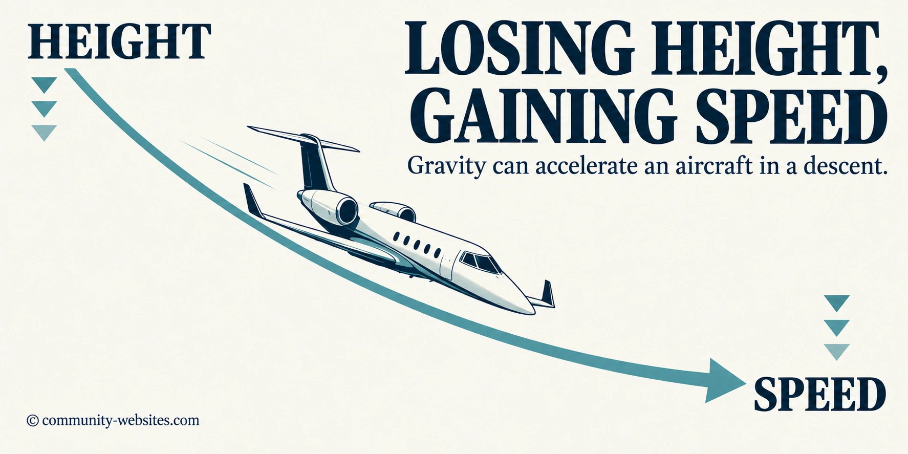
A controlled descent balances those forces within the airplane’s operating limits. In an upset, that balance can change quickly. As the nose drops and the flight path steepens, the airplane may gain speed while the crew is also trying to correct its attitude—the direction the nose and wings are pointing.
Greater speed changes the loads on the aircraft and the response required to bend its path back toward level flight. The problem is no longer simply to stop losing height. It is to bring a fast-moving aircraft through a recovery maneuver within the strength and aerodynamic limits of its structure.
This explains how an emergency can change character within seconds. A condition involving too little airspeed or disturbed airflow at the start can develop into a dive with too much speed later. The overspeed call describes the aircraft’s condition during the descent, not necessarily the event that initiated it.
Why the right-hand turn matters
Lift is the aerodynamic force that supports an airplane in flight. With the wings approximately level, much of that force acts upward. When the aircraft banks, or tilts its wings, the lift direction tilts too. Part of it then acts sideways, helping turn the aircraft.
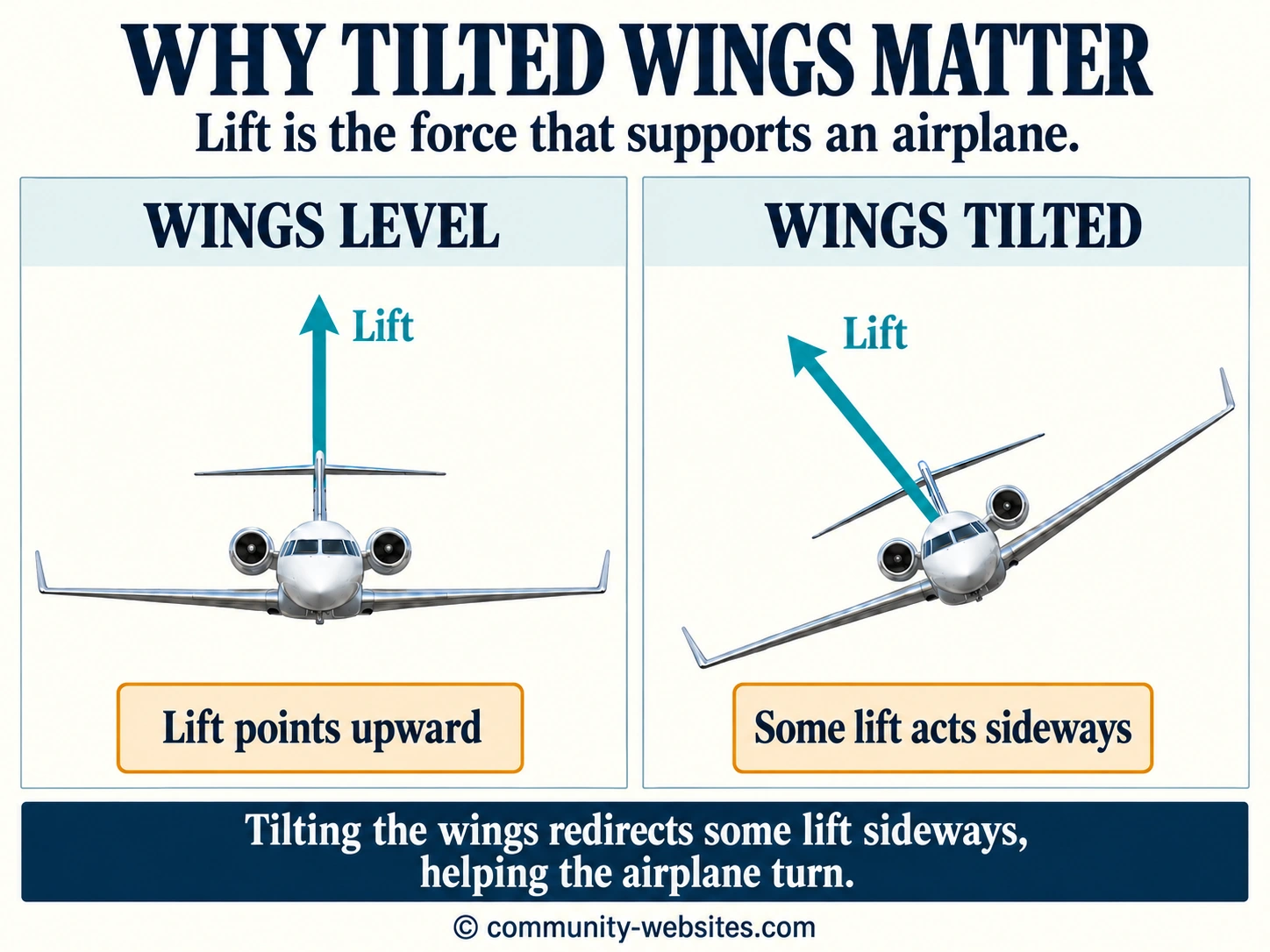
In a level turn, an airplane must produce additional total lift to keep enough of it acting upward. As a general example, a coordinated level turn at a 60-degree bank requires roughly twice the aircraft’s weight in lift. That familiar “2 G” relationship applies to a level turn; it is not a measurement of the loads N722BD experienced in its changing descent. The FAA’s Pilot’s Handbook of Aeronautical Knowledge explains the relationship between bank, lift and load factor.
In a steep descending turn, pulling back on the controls can increase loading and tighten the curved flight path without immediately stopping the loss of altitude. The aircraft’s bank and pitch must be understood together. An airplane tilted substantially to one side does not respond to a backward pull in the same way as one with level wings.
The FAA’s discussion of spiral dives describes the danger of increasing speed and load in a descending turn. This provides a useful aerodynamic framework for the right-hand descent visible in the tracking account. It does not require the airplane to make a full circle: a dangerous descending arc can develop over only part of a turn.
What could have triggered the upset?
One possible initiating event is an aerodynamic stall during the climb. A stall occurs when a wing meets the oncoming air at an angle too great to maintain effective airflow and lift. It can occur with the engines running normally. The word describes the wing’s aerodynamic condition, not an engine shutting down.
A climb requires energy. If the aircraft’s demand for climbing performance exceeds what its current thrust and speed can support, airspeed can decrease. Ice contamination or turbulence can further change the margin between the aircraft’s current condition and a stall. If the two wings lose lift unevenly, a stall can be accompanied by a roll as well as a downward movement of the nose.
In that possible sequence, the original problem develops during the climb attempt. The nose then drops, the airplane accelerates and the emergency becomes a high-speed descent. A late overspeed report would be compatible with such a progression, but it would not establish that a stall occurred first. FAA stall guidance emphasizes the wing’s angle to the airflow as the defining factor.
Instrument information and pitch control are other areas that warrant examination. Air-data instruments supply speed and altitude information. Pitch trim helps balance forces that move the nose up or down. An erroneous indication, an unexpected control command or a trim problem would represent different initiating mechanisms, each requiring evidence from the aircraft’s systems and recordings.
The key investigative task is to identify the order of events: the airspeed and attitude before the climb, the selected control modes, the first unexpected movement, and the aircraft’s response to the crew’s inputs. The public track alone cannot resolve those cockpit details.
High speed can add a second aerodynamic problem
At high Mach numbers, airflow over parts of a wing can reach the speed of sound before the whole airplane does. Shock waves and changes in the pressure distribution can then affect stability and control.
One effect discussed in FAA high-altitude guidance is Mach tuck: a change in aerodynamic forces that can encourage the nose to pitch downward. Other high-speed flow changes can alter how effectively the control surfaces work.
Such effects are relevant when examining a jet that has accelerated beyond an operating limit. If they developed during this descent, they could have complicated the recovery after the initial upset. Establishing their role requires airspeed, Mach and control-response data; an overspeed transmission by itself does not demonstrate that the controls jammed or that recovery became mechanically impossible.
What the last altitude of 8,750 feet means
Flightradar24’s final received altitude was 8,750 feet. Relative to the earlier 35,000-foot flight level, that represents a loss of 26,250 feet—almost five vertical miles—before the end of the publicly summarized track.
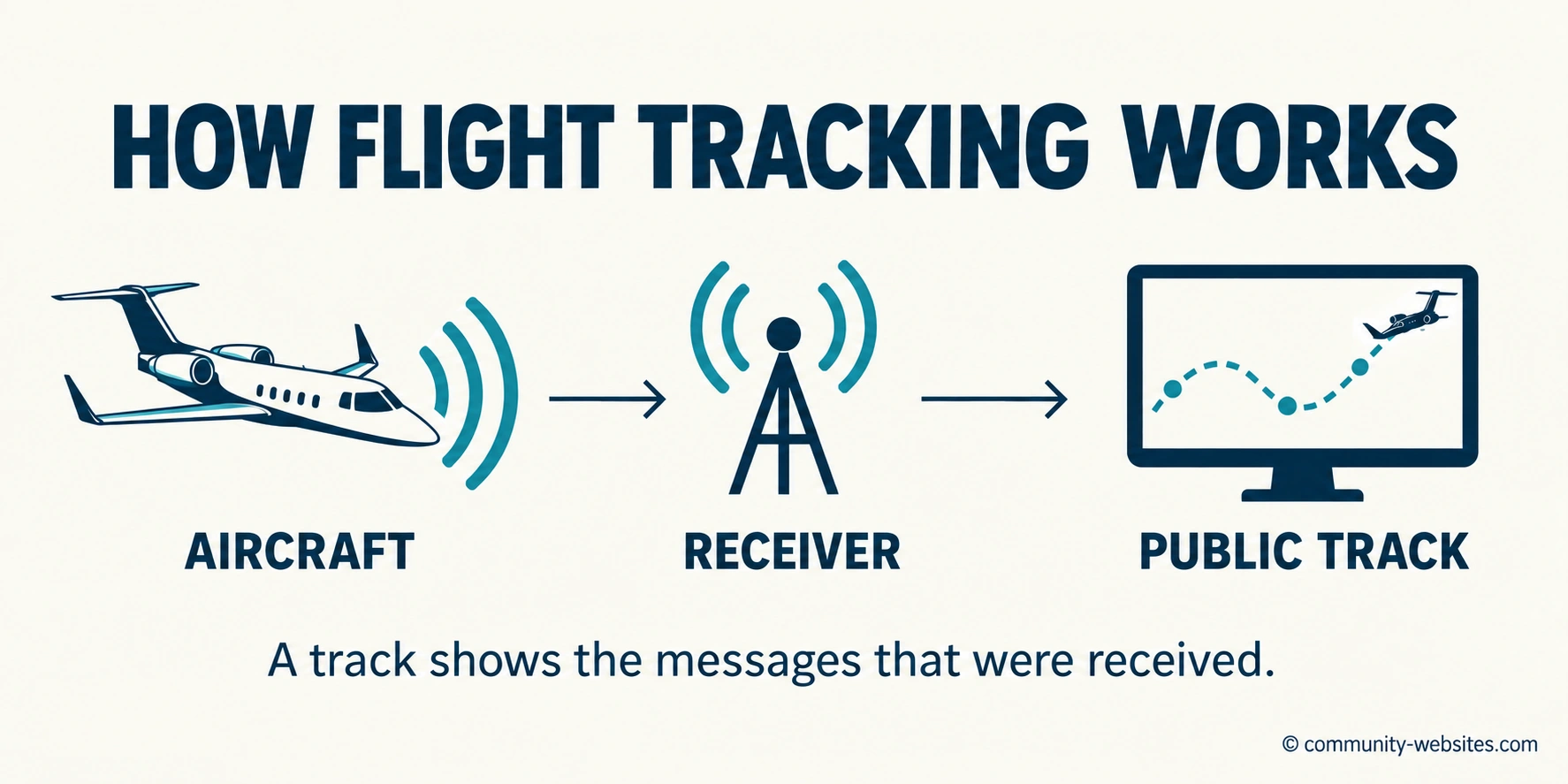
ADS-B tracking depends on aircraft broadcasts reaching receivers and then being processed by a tracking network. Each plotted point reflects received information at a particular time. When reception ends, the aircraft continues moving; the public display does not necessarily follow it all the way to impact.
The last altitude is therefore an endpoint in the available tracking record. It is not the height of the crash site or evidence that the airplane stopped descending there. Determining why a particular feed ended requires its underlying message timestamps, reception history and altitude fields.
Pressure-derived altitude and satellite-derived altitude also measure height differently. Comparing them can be useful, but only with the original data and the appropriate corrections. A single final number cannot establish a blocked pressure sensor or a failure caused by high-speed airflow.
The developing picture
The sequence is a high-altitude upset followed by a steepening, accelerating descent to the right. Weather concerns preceded the climb request. The brief climb then gave way to an emergency in which the crew reported excessive speed while flight tracking recorded a dramatic loss of height.
The aerodynamic problem was cumulative: increasing speed changed the loads, bank redirected the lifting force, and continuing descent reduced the room available for recovery. Together, those factors explain why an aircraft can begin an emergency miles above the ground and still run out of altitude in a very short time.
The investigation must now connect that flight path to its starting event. Weather reconstruction, aircraft condition, maintenance history, communications and recoverable onboard information will be central to determining whether the first disruption involved a stall, an instrument or control problem, or another mechanism.
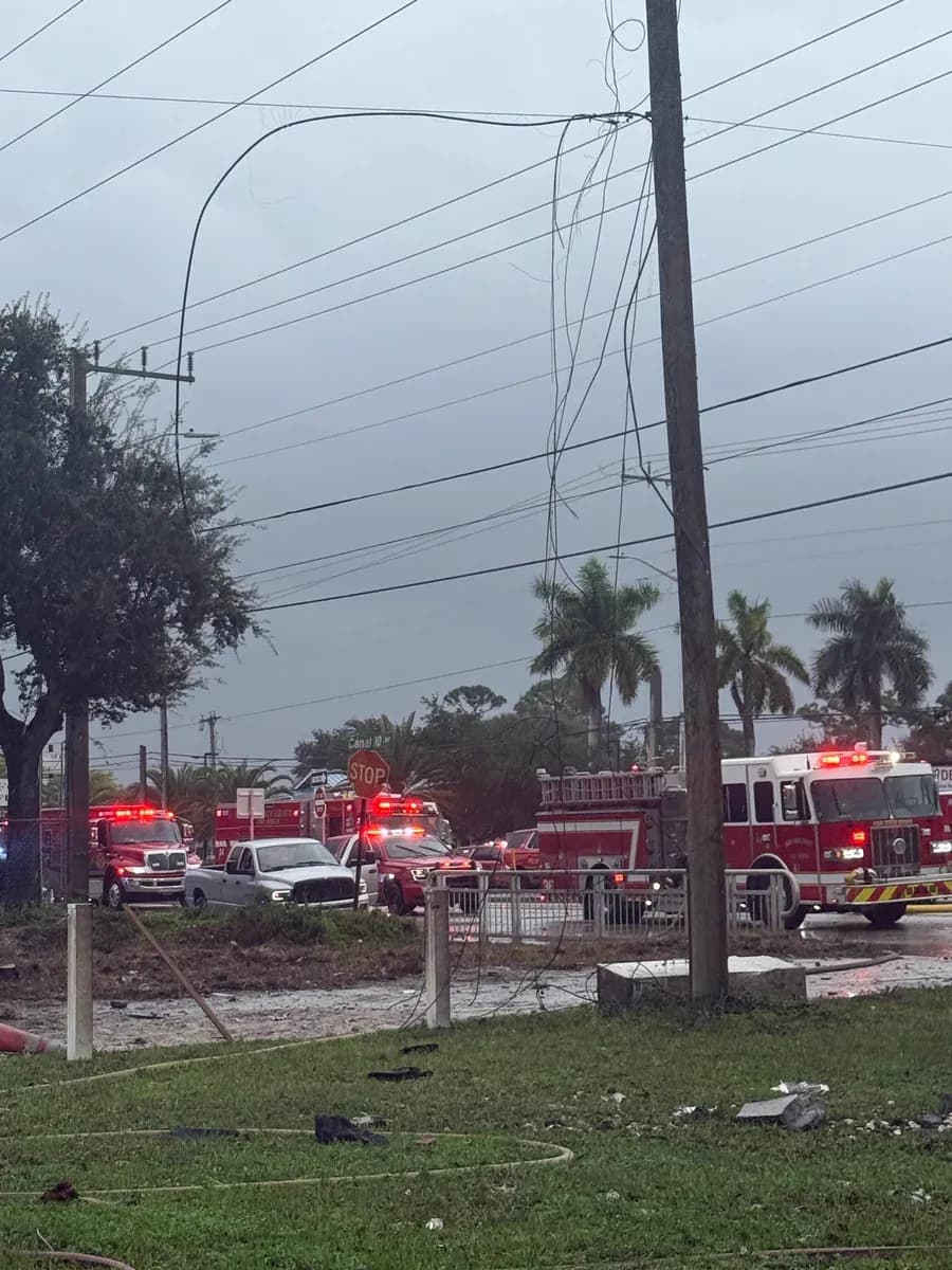
For the ground response and road closures, see our Palm Beach County crash coverage.
Analysis updated November 1, 2026. Times are Eastern Standard Time unless otherwise specified.
What do you think?
Share your perspective with your neighbors.
Free to join. Your draft stays here while you sign in.